Day 2 - Munising
Munising
MUNISING: https://www.munising.org/
*****GRAND MARAIS TO MUNISING: THE FIFTY MILES OF HEAVEN TRAVELING COUNTRY ROAD H-58 IS ONE OF THE MOST SCENIC IN MICHIGAN - along pictured rocks lakeshore
Point Iroquois Light Station - 20 miles West of Sault Ste Marie and 51 miles East of Tahquamenon Falls
Overview of the Tahquamenon Scenic Byway
Depending on which direction you’re coming from, the scenic portion of M-123 begins in Newberry and ends in Eckerman, both at M-28. This unusually U-shaped, 63-mile highway makes a uniquely remarkable journey.
SCENIC DRIVE: M-123 to H58; scenic and winding! https://www.awesomemitten.com/m123-tahquamenon-scenic-byway/
BEGIN your M-123 road trip in Newberry!
Hamilton Lake Natural Area
After enjoying a dose of history and culture, head south on the Tahquamenon Scenic Byway toward the Hamilton Lake Natural Area. This remote natural area is perfect for anyone who wants to get away from it all while simultaneously experiencing the untouched beauty of the Upper Peninsula.
The glistening Hamilton Lake is surrounded by flowers and wildlife, so don’t forget to stop by the scenic overlook to take a picture with the water in the background. It’s one of the best photo spots of the road trip.
Crisp Point Lighthouse
If you’re embarking on a summer road trip on M-123, you must include time to venture north to Crisp Point Lighthouse, too. Known as one of the most isolated and remote lighthouses in the Upper Peninsula, it was inaccessible until 1999, when a road was built to connect M-123 to the light tower.
Curley Lewis Memorial Highway
Heading east from the Tahquamenon Scenic Byway, driving the Curley Lewis Memorial Highway is almost like taking a vacation from your vacation. It’s another scenic roadway that you must drive if you want to experience the incredible Lake Superior shoreline.
With a few slight curves and hills, the highway is known as a gentle stretch of road that will take you to various points of interest, including the Point Iroquois Lighthouse and the Mission Hill Overlook.
Point Iroquois Lighthouse
In the final stretch of your M-123 road trip, you have the opportunity to stop at Point Iroquois Lighthouse. This stately tower was first built in 1855, and for more than 107 years, it allowed fishermen and shippers on the water to navigate their way safely around the rocky shores.
Today, it’s a historical destination that has been lovingly restored. Travelers to the area are invited to learn more about the role that this lighthouse played and to climb to the top of the tower to enjoy the panoramic views.
- Gnoozhekaaning (Bay Mills Indian Community) exhibit: Closed for renovations in 2025
- FS Maritime Museum and ENFIA outlet: Tuesday through Saturday 11am-4pm
- Tower: Tuesday- Saturday 11am-4pm
- Operating season: June 10th through October 17th
- Public Restrooms: May 24th through October 18th
-
Directions
From the intersection of M-28 and I-75 drive 7.5 miles west on M-28 to M-221/ Brimley. Turn right (north) and drive 2.5 miles on M-221 to Lake Shore Drive (FR 42). Turn left (west) on Lake Shore Drive and drive 6.5 miles to the lighthouse.
GPS Coordinates
Latitude: 46.484405
Longitude: -84.630429
Front Range Lighthouse
Grand Island Harbor Scenic Turnout
The Curtains Ice Climbing Area
Glass Bottom Shipwreck Tours
https://shipwrecktours.com/schedule-rates/
(Schedule and rates are subject to change without notice)
Buying tickets early is highly recommended as space is limited.
Tours run 7 Days a week, rain or shine from Memorial Day weekend to September 30th.
Wheel/power chair, accessible tours depart at 10AM, 1PM & 4PM on the Shipwreck Express.
Tour Season 2025
Eastern Standard Time
- Memorial Weekend, May 24 & 25: 10am,1pm,4pm
- May 26 - June 20: 10am & 1pm
- June 21 - June 30: 10am, 11:30am,1pm, 2:30pm. (4pm added June 23rd.)
- July 1 - August 17: 10am, 11:30am,1pm, 2:30pm, 4pm
- August 18 - August 30: 10am,1pm 4pm
- Labor Day Weekend: 10am, 11:30am, 1pm, 2:30pm, 4pm
- Sept 1– Sept 30: 10am & 1pm
Daily Tours
Fully narrated, educational and entertaining, two hour tour explores two historical shipwrecks, the Bermuda (sank 1870) and Herman H. Hettler (sank 1926). Cruise by Grand Islands' East Channel Lighthouse (constructed 1867) and colorful rock cliffs, caves, beaches and pristine wilderness. And let's face it, looking through a glass bottom boat is just cool!
Munising Falls Hike! 0.4mi - CLOSED due to paved trail being washed out
Hikes: https://www.nps.gov/piro/planyourvisit/hikes.htm
Miners Falls Trail 1.2mi - 2.0 miles round trip
sand Point Marsh Trail - 0.5 mi loop - go early or late in the day for wildlife activity; see the wetlands
Wagner Falls - serene and overlooked
Miner's Castle - The ONLY cliff area accessible by vehicle. 200-1300 ft one way. 3 different viewing platforms. https://www.munising.org/activities/miners-castle-overlook/
Grand Island Boat Tour - https://riptideride.com/
Food
- **Tracey's!
- Falling Rock Cafe (GF breads and soups)
- Pictured Rocks Pizza (GF)
- Driftwood Deli (GF)
- Falling Rock Cafe and Bookstore
- Tacopotamus (GF) - Food Truck - https://www.facebook.com/JavierTheHungryHippo/?ref=page_internal
- Eh! Burger (GF)
- Border Grill
- The Dogpatch Restaurant
- Foggy's Steakhouse and Lounge
- Buckhorn Resort Restuarant
- rollin' Smoke BBQ - Food Truck - https://www.facebook.com/RSBUP/
Shopping
- Open Wings Pottery & Down Win sports?
HOTEL: https://www.munising.org/stay/
Tahquamenon Falls
AT LEAST 4 HOURS AT THE FALLS!
It is open 8 a.m. to 10 p.m. daily, all year round. To access the park, you will need a current Michigan Recreation Passport for residents or non-residents.
Tahquamenon Falls is a 77.5-mile (1.5-hour) drive from Grand Marais and an 88.3-mile drive (just over 1.5 hours) from Munising, the two gateways to Pictured Rocks National Lakeshore.
Directions
Tahquamenon Falls State Park Upper Parking Lot!
Tahquamenon (Tah-kwa-me-non) Falls State Park is located at (LOWER FALLS) 41382 W. M-123, Paradise. There is also an entrance to the park on M-123 in Newberry. GPS: 46.610734,-85.206323
Upper Falls^^ (Construction on viewing platform set to wrap on 10/01/25 but all three other platforms are open and available.)
Tahquamenon Upper Falls
The Upper Falls at Tahquamenon is the park’s premier attraction. The beautiful waterfall is 200 feet wide and drops 50 feet into the river below. The water is an interesting brown color that churns into a rainbow hue of mahoganies and tans.
The color comes from tannins leached from the surrounding cedar and hemlock trees and is not, as some jokingly claim, the run-off from a nearby root beer factory. This is why you’ll sometimes hear this waterfall called Root Beer Falls.
To reach the Upper Falls viewing area, simply walk about ¼ mile to reach the overlook. This is a great spot to snap some photos of the falls.
If you want a closer look, heading to the brink viewing platform is a great idea, just be prepared for steps! You’ll need to climb down 93 of them. If you want an even closer look, you can climb down another 112 steps to reach the river. Beautiful!
*To reach the Upper Falls, walk a short distance from the parking lot and follow the ⅓-mile ADA-accessible paved path and boardwalk to the viewing area. For a closer look at the brink, you will need to descend 94 steps. From the paved path, you also can take a right at the fork and descend 116 steps to the base of the gorge. A long boardwalk path takes you to a viewing area that gives you the most direct view of the falls.*
Tahquamenon Lower Falls
Although the Upper Tahquamenon Falls is the larger and more famous cascade, the Lower Tahquamenon Falls are absolutely worth a visit.
These falls are actually a series of five waterfalls surrounding a small island, creating a tranquil and picturesque scene.
The Lower Falls viewing area receives fewer visitors than the Upper Falls–perfect if you don’t fancy crowds! Take a look at the falls from the different viewing platforms. Walk along the boardwalk to get to one of the prettiest viewing points: a platform at the edge of the trees.
There is now a footbridge to the island! A 0.4-mile, ADA-accessible path from the parking lot takes you to viewing areas along the river bank. A 143-foot, universally accessible pedestrian bridge offers beautiful views of the falls and Tahquamenon River. Once on the island, you can take an ADA-accessible boardwalk around the island for close-up views of the falls. There are also ADA-accessible restrooms and a concession store are also at this site. The lower falls has an excellent .75 mile boardwalk to the viewing platforms and a little island you can walk around to take in the sights. I believe they are still working on the upper falls viewing platform so that’s a 100-step staircase down/up to view them.
Tahquamenon Falls Brewery and Pub
Camp 33 Gift Shop
What Else Is There To Do Near Tahquamenon Falls?
One of the best ways to enjoy the beauties of Upper Peninsula Michigan is with a road trip!
Head down the M-123 Tahquamenon Scenic Byway.
Continue along Lake Superior to visit Crisp Point Lighthouse, one of the most beautiful lighthouses in Michigan State.
Crisp Point Lighthouse: 1944 Co Hwy 412, Newberry, MI 49868
Tahquamenon Falls-Nature Trail: 0.5mi - A half-mile, forested trail offering an alternative route from the Upper Falls viewing area back to the parking lot. The trail is groomed for cross-country skiing and integrated into the park’s lantern-lit winter trail program. The Nature Trail provides an alternative half-mile route from the Upper Falls viewing area back to the parking lot. This forested trail features excellent birding during spring migration and is carpeted with ferns during the summer. The Nature Trail is integrated into the lantern-lit cross-country ski and snowshoe program typically offered every Saturday in February.
Dark sky park is great here too!
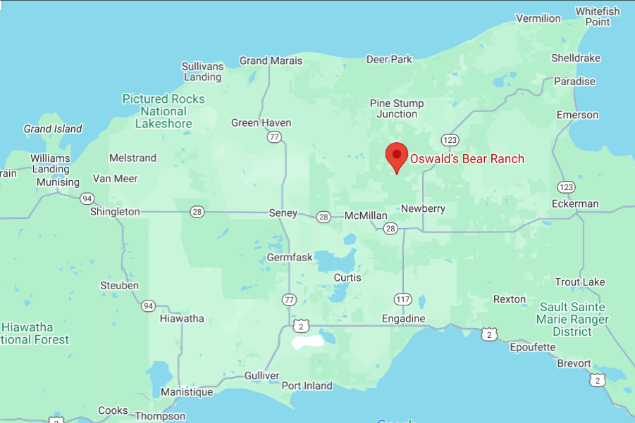
Oswald's Bear Ranch
https://www.oswaldsbearranch.com/
Open from Memorial Day through October 10th. $30/car. 9a-5p
Pictures with cubs $10/group
Mixed reviewed on morality.
Grand Marais
Pickel Barrel House
Harbor of Refuge - Inner and Outer Lighthouse